While pilgrims crowd the Camino Francés, an almost forgotten path winds through the vineyards and gorges of Galicia: the Camino de Invierno. 263 kilometers from Ponferrada to Santiago de Compostela – through some of Spain's most spectacular landscapes.
Why "Winter Route"?
The name sounds daunting, but its origin is practical. Since medieval times, pilgrims used this route to bypass the snow-covered pass over O Cebreiro during winter. Instead of climbing to 1,300 meters, the Camino de Invierno follows milder river valleys and stays at lower elevations.
Today, the Winter Route is walkable year-round – and especially during summer months, it's a welcome alternative to the overcrowded Camino Francés.
Route Overview
The Camino de Invierno starts in Ponferrada, where it splits from the Camino Francés. From there, it heads south into the mountains of León before entering Galicia and passing through the famous Ribeira Sacra all the way to Santiago.
- Distance: approx. 263 km
- Duration: 10–12 stages
- Starting point: Ponferrada (León)
- End point: Santiago de Compostela
- Highest point: approx. 900 m
- Difficulty: Moderate – some climbs, but no extreme altitudes
The Stages
Ponferrada → Las Médulas (approx. 32 km)
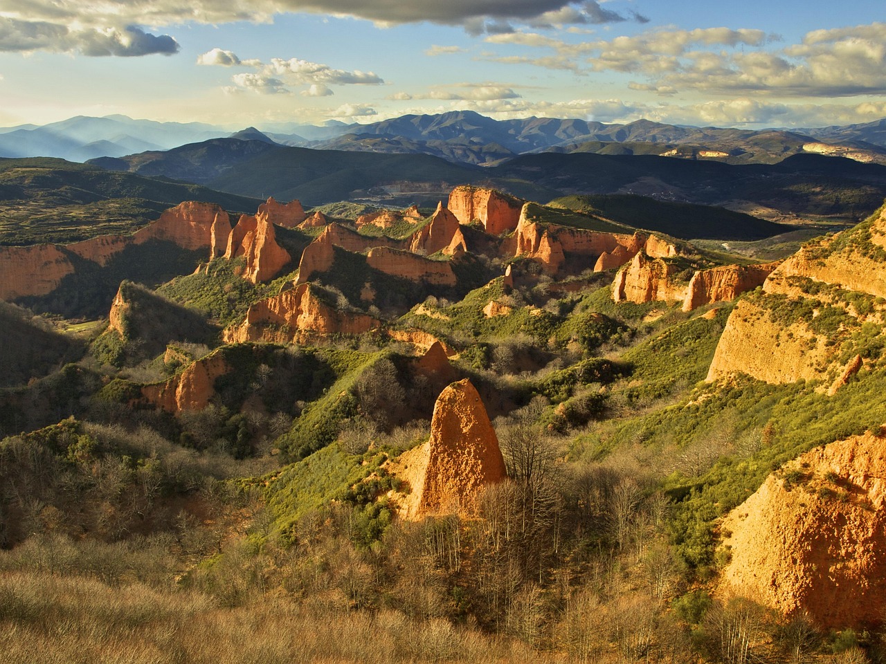
The opening stage leads through the Bierzo wine region. The highlight: Las Médulas, a surreal landscape of red rock formations – a former Roman gold mine and UNESCO World Heritage Site. The reddish rocks nestled among chestnut forests create an unforgettable sight.
Las Médulas → O Barco de Valdeorras (approx. 28 km)
The path follows the River Sil into the Valdeorras wine region, known for its excellent Godello white wine. The stage is relatively flat and passes through sleepy villages.
O Barco → Quiroga (approx. 30 km)
Through the narrow Sil Valley with its steep slopes and wine terraces. The landscape grows increasingly dramatic – deep gorges, forested mountains, barely another pilgrim in sight.
Quiroga → Monforte de Lemos (approx. 33 km)
You reach the heart of the Ribeira Sacra – the "Sacred Riverbank" at the confluence of the Sil and Miño rivers. Romanesque monasteries cling to steep cliff faces, with centuries-old wine terraces below. Monforte de Lemos surprises with its medieval old town and the imposing Colegio del Cardenal.
Monforte de Lemos → Chantada (approx. 30 km)
The route crosses the gently rolling meadows of Galicia. Granite villages, hórreos (traditional granaries), and eucalyptus forests define the landscape.
Chantada → Lalín (approx. 35 km)
One of the more demanding stages with some climbs. Lalín is famous for its cocido – a hearty stew that's perfect after a long day of walking.
Lalín → A Estrada → Santiago de Compostela (approx. 75 km)
The final stages pass through quintessential Galician countryside. Morning mist, green meadows, ancient stone walls. At Silleda, the Camino de Invierno meets the Vía de la Plata before both routes lead to Santiago together. After the quiet days on the Winter Route, the moment you first spot the cathedral feels especially powerful.
Highlights of the Camino de Invierno
- Las Médulas: The surreal red rock formations of the former Roman gold mine – a UNESCO World Heritage Site
- Ribeira Sacra: Steep wine terraces along the Sil gorges – one of Europe's oldest wine regions
- Romanesque monasteries: Santo Estevo, Santa Cristina, and other jewels of medieval architecture
- Solitude: Where hundreds of pilgrims walk the Camino Francés, you're often alone here
- Galician gastronomy: Pulpo, empanadas, cocido, Godello wine – the Winter Route is a culinary delight too
Practical Tips
Best Time to Go
Despite the name: April to June and September to October are ideal. During midsummer, the river valleys can get very hot. In winter, the route is walkable, but infrastructure (hostels, restaurants) is limited.
Accommodation
Infrastructure is less developed than on the Camino Francés. There are pilgrim hostels in larger towns, but you should plan ahead. In small villages, there's often only one lodging option – or none at all.
Waymarking
The route is marked with yellow arrows, but not as consistently as on more popular routes. A GPS app or GPX file on your phone is highly recommended.
Pilgrim Credential
The Camino de Invierno officially counts for the Compostela – the pilgrim certificate in Santiago. You need stamps from at least the last 100 km.
Who Is the Camino de Invierno For?
The Winter Route is perfect for you if you:
- Want to experience the Way of St. James away from the crowds
- Love spectacular nature and wine culture
- Have already done a Camino and are looking for something new
- Don't mind less infrastructure and a bit more planning
- Enjoy the solitude on the trail rather than fearing it
Your Route as a Keepsake
263 kilometers through gorges, vineyards, and Galician villages – the Camino de Invierno is a journey you won't forget. And that's exactly why it deserves a place on your wall.
With Track To Print, you can immortalize your Camino route as a high-quality map poster. Simply upload your GPX file, customize colors and text, and capture your pilgrimage as artwork – printed on premium paper or as a digital download.
Your Camino. Your route. Your poster.
Image from von António Cascalheira auf Pixabay